


ABPmer creates innovative underwater noise mapping tool
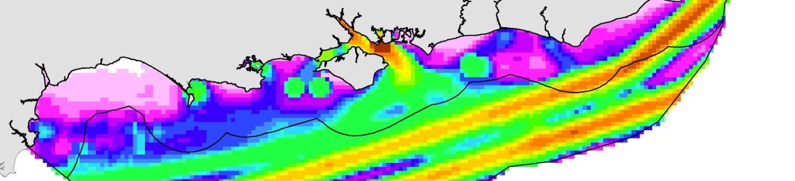
The outputs of the GIS tool will improve the MMO’s understanding of underwater noise, and may also inform marine planning and decision making processes.
ABPmer, a specialist in marine data and management, has been contracted by the Marine Management Organisation (MMO) to create a GIS tool that generates data to map the distribution of man-made continuous underwater noise in the south marine plan areas.
The outputs of the tool will improve the MMO’s understanding of underwater noise. They may also inform marine planning and decision making processes.
Elena San Martin, EIA and underwater noise specialist at ABPmer said:
“We are excited to be developing such an innovative tool for the MMO.GIS tool that generates data to map the distribution of man-made continuous underwater noise in the south marine plan areas. The marine environment experiences noise from both natural and man-made sources. Over the past decade, there has been a growing recognition of the potential harm of man-made underwater noise.
“Although challenging to develop, the maps will assist in the creation of sustainable development policies in the south marine plan areas.”
ABPmer is a recognised authority in marine planning and has developed a number of related tools. Past developments include scoping a strategic co-existence assessment tool and a data processing tool to decode and display AIS data to understand shipping activity.