ABPmer advises on managing the shingle spit at Pagham Harbour
ABPmer will determine appropriate intervention for the large shingle spit fronting Pagham Harbour, to ease the pressure of erosion it is placing on the foreshore.
Read article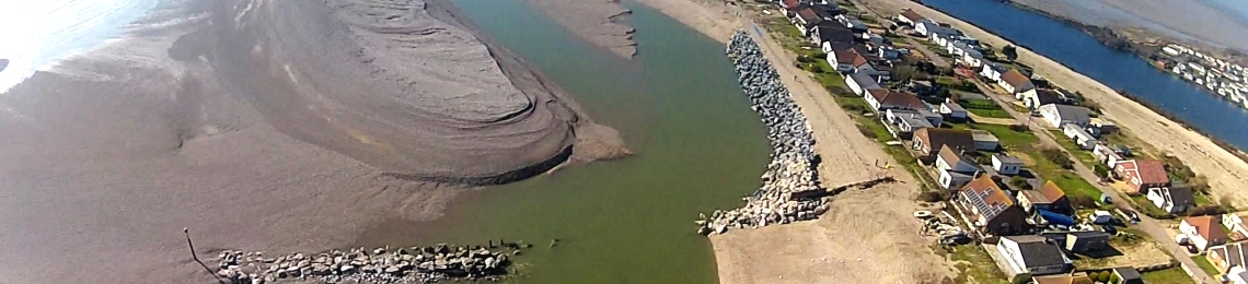


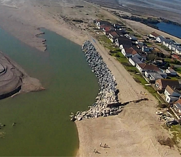
This spit feature has grown substantially over the last decade, creating an extended tidal channel that now runs in front of the adjacent foreshore.
The working group for Pagham Parish Council, Pagham Flood Defence Steering Group (PFDSG), has contracted ABPmer to identify the best solution for managing the large shingle spit fronting Pagham Harbour, West Sussex.
This spit feature has grown substantially over the last decade and has created an extended tidal channel that now runs in front of the adjacent foreshore. This extended spit and long-shore channel are exerting erosive pressure on the Pagham beach and posing ongoing threats to properties along the beach frontage.
This evolving shoreline morphology has also resulted in shingle not being allowed to enter into the natural long-shore sediment transport pathways. Instead the shingle continues to be ‘locked up’ within the spit and is not being moved ashore because of the strong flows occurring through the now elongated tidal channel. This reduction in the shingle supply is also exacerbating beach erosion problems further along the shoreline.
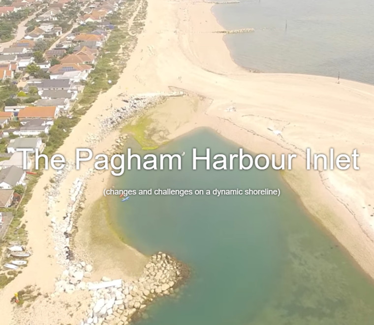
Throughout its history, Pagham Harbour has been a very dynamic site and subject to continual change both through natural processes and human intervention. It is also a location of high nature conservation value and one where there is an identified needed for an ongoing process of adaptive management in response to the changing conditions.
We have undertaken an initial review of the situation drawing upon the large amount of evidence and research that has been conducted at this site. It was concluded that the most appropriate approach solution is to create a controlled breach through the spit at a location where the breach was previously located. The material excavated from this breach can then be side-cast to block the existing channel that now runs along the beach face.
To preserve the overall functioning of the shoreline, this new breach needs to be as natural as possible with no ‘hard’ cross-shore structures such as training walls etc. Such an intervention is considered to be the most sustainable, ‘soft solution’ for this particular site in view of its history and the dynamics of the environment. ABPmer is now working with PFDSG and stakeholders to scope an Environmental Impact Assessment for this work and to secure all the necessary permissions for it to be undertaken.
Colin Scott, coastal realignment specialist at ABPmer said:
“We are delighted to have been contracted to do this work for PFDSG. Pagham Harbour is a location which exemplifies the challenges of managing, and living beside, an ever-changing coastal environment. It also illustrates how we need to work with and not against natural process at the coast.
Our team is very familiar with these issues and successfully carried out the bulk of the scheme design, coastal modelling and impact assessment work that was needed to secure the consents for the Medmerry managed realignment project on the adjacent coastline. We therefore bring to this project detailed understanding of the evolution and maintenance of the shingle defences along that frontage as well as a wealth of experience in EIA and related consents for such projects.
We have already had productive meetings with regulators as the project is on a tight schedule to complete the necessary assessment work and secure the required consents to allow for this intervention to take place before this coming winter.”
ABPmer is a recognised leader in adapting shorelines for flood protection, nature conservation and other purposes, having been engaged in more than 10 such schemes in the past five years. For further information on this subject, visit the OMReg habitat creation database.
For more information about our work at Pagham, visit our project page.
Image copyright Pagham Flood Defence Steering Group
ABPmer will determine appropriate intervention for the large shingle spit fronting Pagham Harbour, to ease the pressure of erosion it is placing on the foreshore.
Read article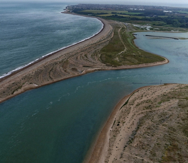
We are delighted that planning consents have been granted for a proposal to manage the large shingle spit in front of Pagham Harbour in West Sussex.
Read article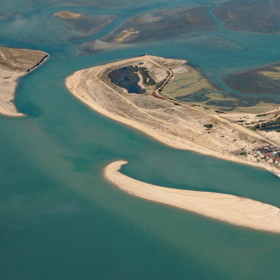
We have created an online story-map describing coastal change along the Pagham (West Sussex) shoreline. Our specialists have used ArcGIS Online mapping software to integrate text, pictures, videos and maps in a way that allows the story to unfold.
Read article