


Boundaries of all completed UK coastal habitat creation schemes added OMReg
We are pleased to announce that we have added a boundaries map of all existing managed realignment and regulated tidal exchange schemes in the UK to our habitat creation and restoration database, OMReg
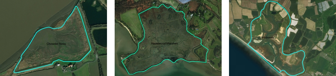
From our work, as a leading consultancy in the field of intertidal habitat creation, we recognise that it can often be difficult to pinpoint the location of completed projects let alone view the boundaries of these sites.
We hope the boundaries update will be useful for the many practitioners, academics, students and other interested parties who want to see the extent of completed habitat creation projects in the UK.
View the updated OMReg database
How we did it
The boundaries update was created from various sources. Firstly, we used in-house data from the many UK sites that ABPmer has had direct involvement in designing, assessing and implementing.
Secondly, using existing information from OMReg, we collected numerous maps which and used them to draw the outlines of the sites. Outlines have also been based on aerial imagery where available.
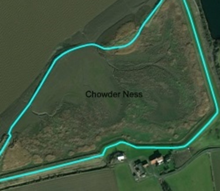
The boundaries of those sites which are surrounded by embankments were relatively easy to draw. Sites where a natural transition into rising ground exists were somewhat trickier. Here, the approximate line of Highest Astronomical Tide was used as was the evidence from aerial imagery (e.g. obvious vegetation transitions).
Please note that the overall area of habitat creation sites often includes transitional and terrestrial habitats (e.g. mitigation areas).
For the update, mostly intertidal habitats were mapped, with the exception of those sites which are surrounded by embankments, here the embankment crest line was used to delineate the site, and transitional/terrestrial habitat areas would frequently be included within this extent.
View the updated OMReg database
Prepared by Colin Scott, Habitat Creation Business Manager