


Is there a place for drones in intertidal monitoring?
How do Unmanned Aerial Vehicle (UAV) surveys compare to more traditional ground surveys when monitoring the development of managed realignment sites? This was a question which was recently investigated by ecological surveyors during the annual monitoring of Welwick managed realignment site on the Humber Estuary.
Unmanned Aerial Vehicles (UAVs) are increasingly being used to collect high resolution spatial data for a variety of marine and coastal monitoring. Like other coastal surveyors, ABPmer is excited by the opportunities that they can provide to improve quality and coverage of coastal surveys.
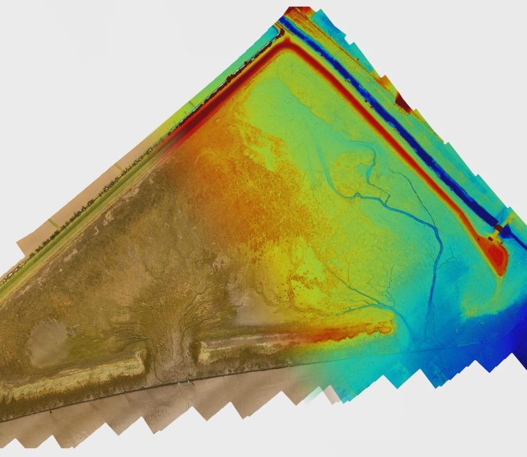
We have been monitoring the Welwick managed realignment site for more than ten years as part of the Humber Environmental Management Plan. Every year, we gather and analyse intertidal biological samples as well as map the extent of different broad habitats (such as saltmarsh and mudflat) using a RTK GPS. We also collect elevation data to ground truth Light Detection and Ranging (LIDAR) data.
The UAV survey gave us:
- An orthomosaic map: Imagery stitched together and geometrically corrected (“orthorectified”) to produce an accurate map;
- Normalized Difference Vegetation Index (NDVI) mapping: Quantifies vegetation by measuring the difference between near-infrared (which vegetation strongly reflects) and red light (which vegetation absorbs)
- Elevation data; and
- 3D mapping: a 3D topographic map using 3D photogrammetry software.
When compared with existing aerial imagery of the site (such as satellite) the UAV, when combined with our field surveys, offered a greater level of detail on the spatial extent of different habitats.
The elevation and mapping data collected by the drone also provided useful complimentary data to use alongside LIDAR and RTK measurements to understand accretion rates at the site.
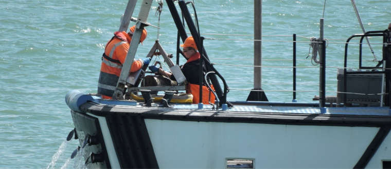
The UAV also collected some excellent footage of the hovercraft sampling survey in action!
Using a drone in the Welwick monitoring project has proved to be an effective technique for surveying intertidal habitat development. It captured up-to-date, high resolution aerial imagery and elevation data as well as provided access to areas that would otherwise be difficult or unsafe to reach.
The benefits found during this monitoring campaign suggests that the outputs from UAVs are a useful addition when monitoring intertidal areas. We intend to explore other applications of drones during future survey programmes.
Prepared by Andrew Pearson, Ecological Survey Specialist
Our marine ecologists have extensive experience in designing and undertaking bespoke surveys based on standardised techniques and established protocols.
Learn more about our survey and monitoring capability.
ABPmer teamed up with Landwatch Consultancy and Intertidal Ltd to trial the use of a drone to assist with data collection.