


Predicting extreme waves and water levels where land meets water
Flooding and infrastructure damage caused by extreme waves and water levels are of growing concern around the UK coastline. Projects to improve coastal defences in response to sea level rise are reliant on predictions of these extreme waves and water levels, for both the present day and future epochs.
Recently ABPmer has used a methodology comprising of regional and local wave models, multivariate statistical analysis and 1-D shoreline models to determine extreme conditions at coastal defences and hence support the design of upgrades.


How we did it
When deep water waves are propagated into shallower water, wave forms are transformed by many processes including: refraction; diffraction; shoaling and bottom friction.
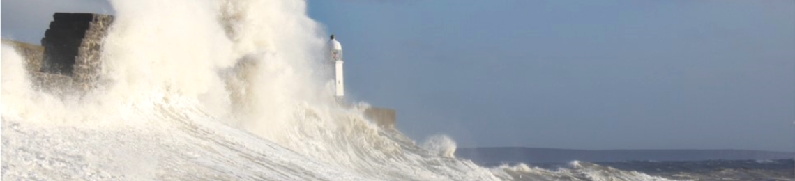
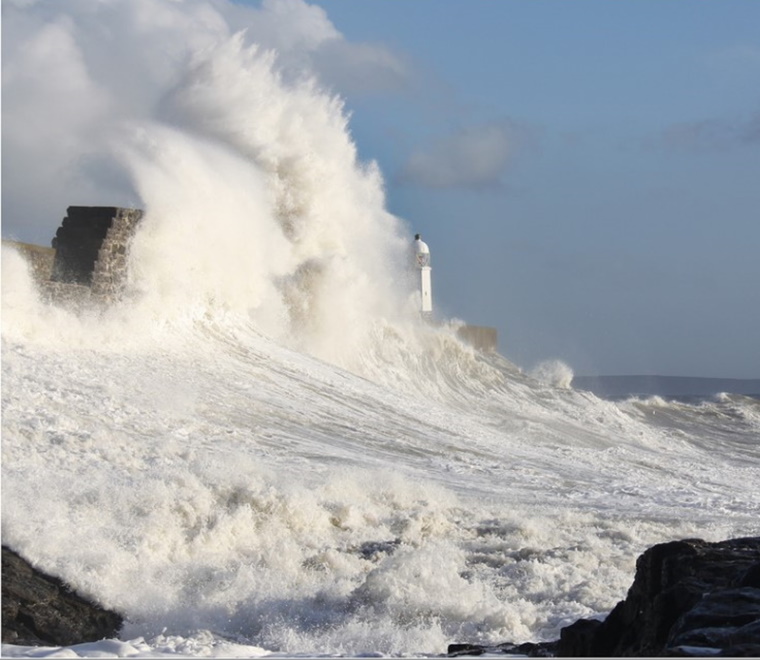
This transformation process continues into the wave breaking zone when the increasing wave steepness becomes unsustainable with resulting complex effects on individual waves in the surf zone including: wave breaking; wave spilling and wave-run up.
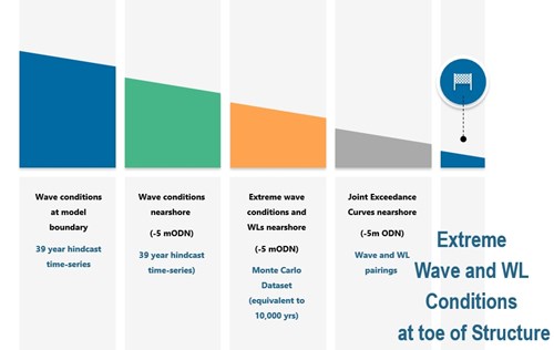
By creating project specific spectral wave models, which use conditions from SEASTATES at the boundary and have high resolution in the area of interest, ABPmer has created long term hindcasts (circa 39 years) of localised areas such as Lyme Bay and the Eastern Solent.
The resolution needed to resolve processes such as wave breaking and wave-run-up in the immediate vicinity of a coastal defence, where water meets land, is very fine and is such that even the high resolution local models are not sufficient.
With this in mind, a 39-year time-series of wave parameters (such as significant wave height and peak period) are then extracted from locations in relatively shallow water (around 5m deep). Extreme Value Analysis is undertaken on these wave parameters to predict events that may be expected to occur over the next 10,000 years. From, this data extended data wave conditions can be determined for a range of Annual Exceedance Probabilities.
Understanding extreme conditions for an individual parameter takes us only part of the way to our solution.
Whilst it’s useful to understand individual parameters, being able to predict the probability of two parameters reaching a set threshold at the same time, for instance a peak water level occurring the same time as an extreme wave, is far more powerful.
To achieve this, multivariate analysis is undertaken using the extreme univariate waves derived and extreme water levels from the EA’s Coastal Flood Boundary Dataset to provide a synthesised set of paired wave and water level events that could be expected to occur over the next 10,000 years.
The final step in the methodology involves using these extreme value pairings of water level and wave height as inputs to a high resolution 1D wave model to transform wave conditions from shallow water (around 5m deep) to the coastal structure.
Prepared by Jonathan Griffiths, Numerical Modeller
SEASTATES is ABPmer’s metocean data and information service. Our SEASTATES wave model provides a well validated hourly hindcast of wave parameters for the North West European Shelf and Baltic Sea during the last 39 years.